2010 M8.8 Chile Earthquake
Special pages - Figures & maps - Reports by IPGP and LIA «Montessus de Ballore»
IPGP special page : In FRENCH
Evaluation of TSUNAMI RUN-UP (page and report)
Papers :
Vigny C., A. Socquet, S. Peyrat, J.-C. Ruegg, M. Métois, R. Madariaga, S. Morvan, R. Lacassin, J. M. Lancieri, Campos, D. Carrizo, M. Bejar-Pizarro, S. Barrientos, R. Armijo, C. Aranda, and the LIA-MdB post-seismic team, and the CAP team. The 2010 (Mw8.8) Maule mega-thrust earthquake of Central Chile, monitored by GPS, SCIENCE, 2011. Go to R. Lacassin publication page to retrieve PDF.
Lacassin R., Les tremblements de terre d’Haïti (Mw 7 - janvier 2010) et du Chili (Mw 8,8 - mars 2010), Géochronique, 2010. PDF
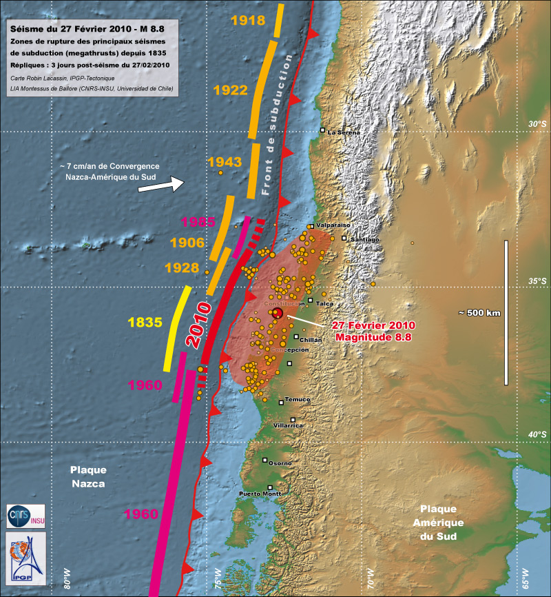
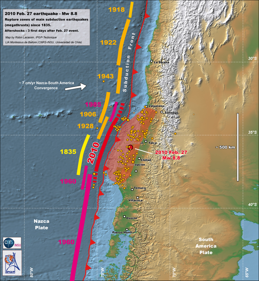
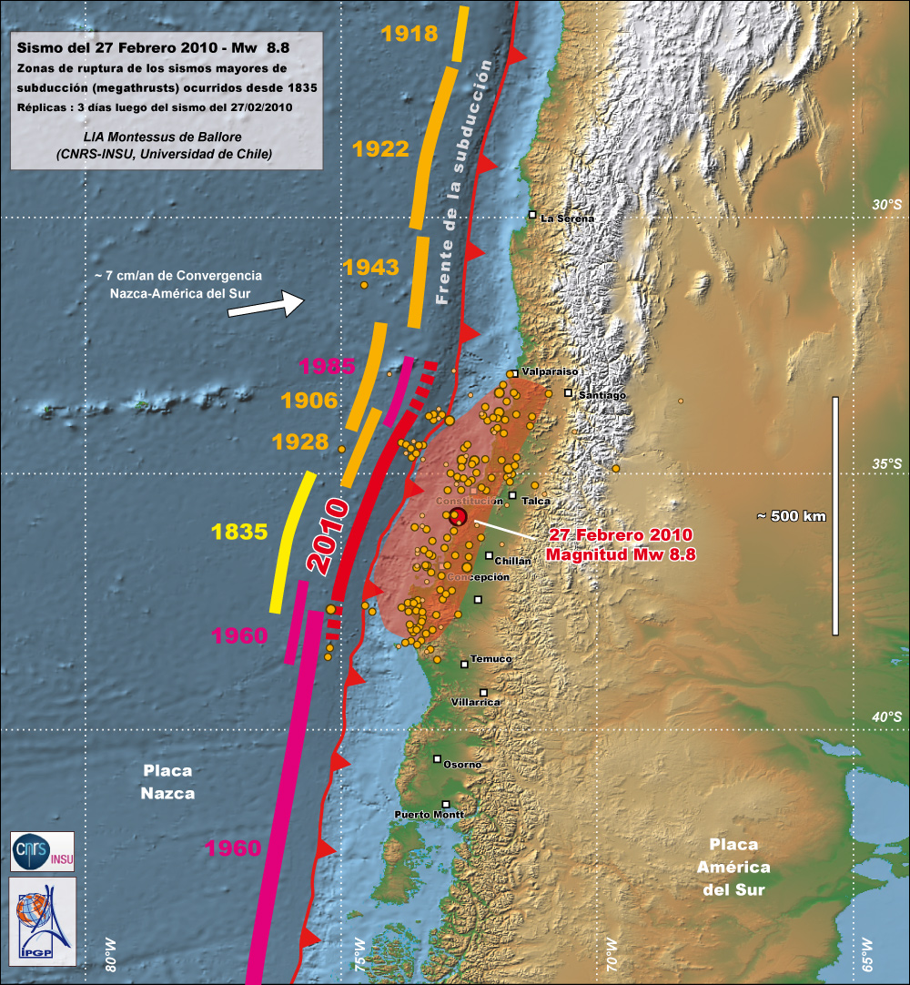
Rupture zones of megathrust subduction earthquakes since 1835. Probable maximum extension of Feb 27th rupture is indicated in red. This earthquake likely broke a segment larger than the length of the Concepción gap which broke in 1835. Click on the figure to see the map in french, or follow this link for a version in english.
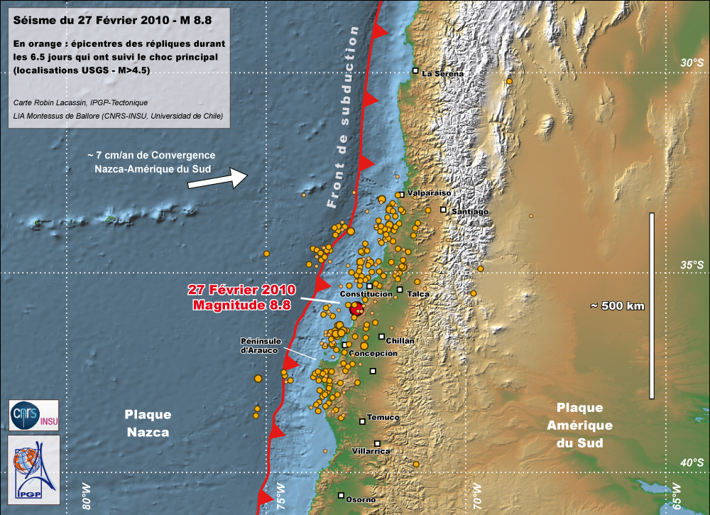
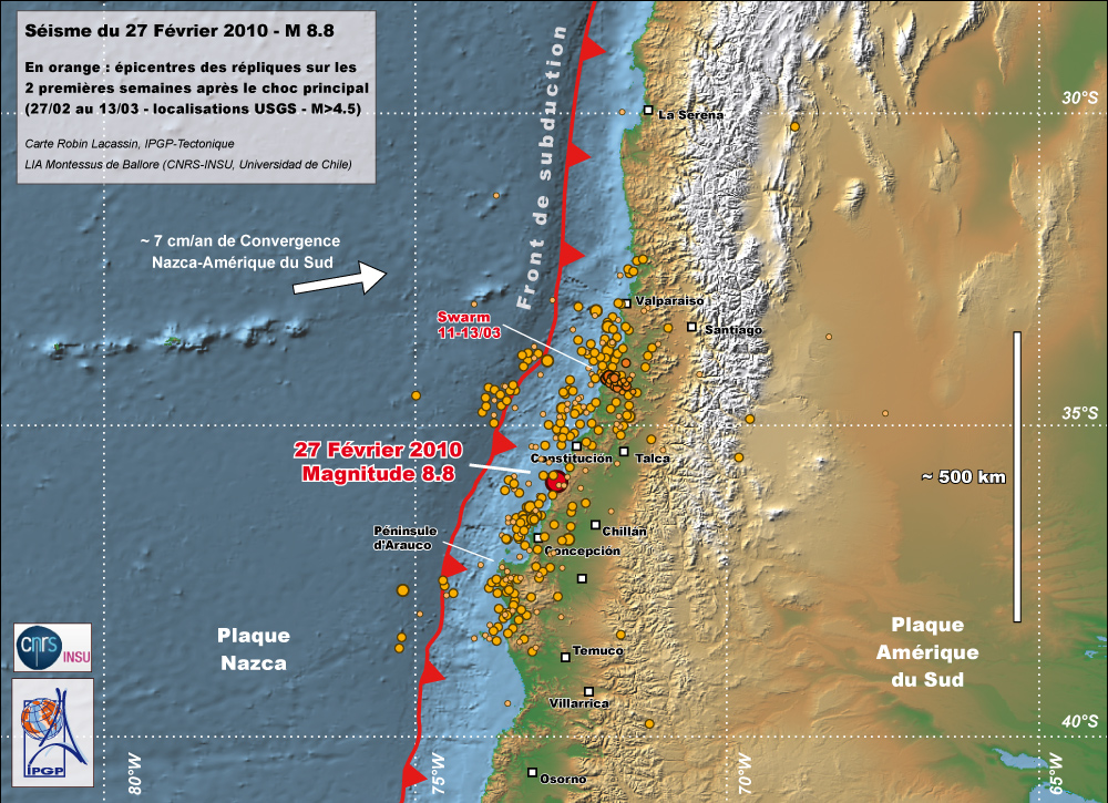
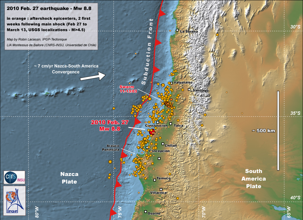
Epicenters of 27th February earthquake and of aftershocks for 6 days after the main shock (USGS localizations). Link to day-by-day aftershock maps. Click on the figure to see the map in french.
Updated versions of these maps :
- Two weeks of aftershocks : Map in FRENCH or in ENGLISH.
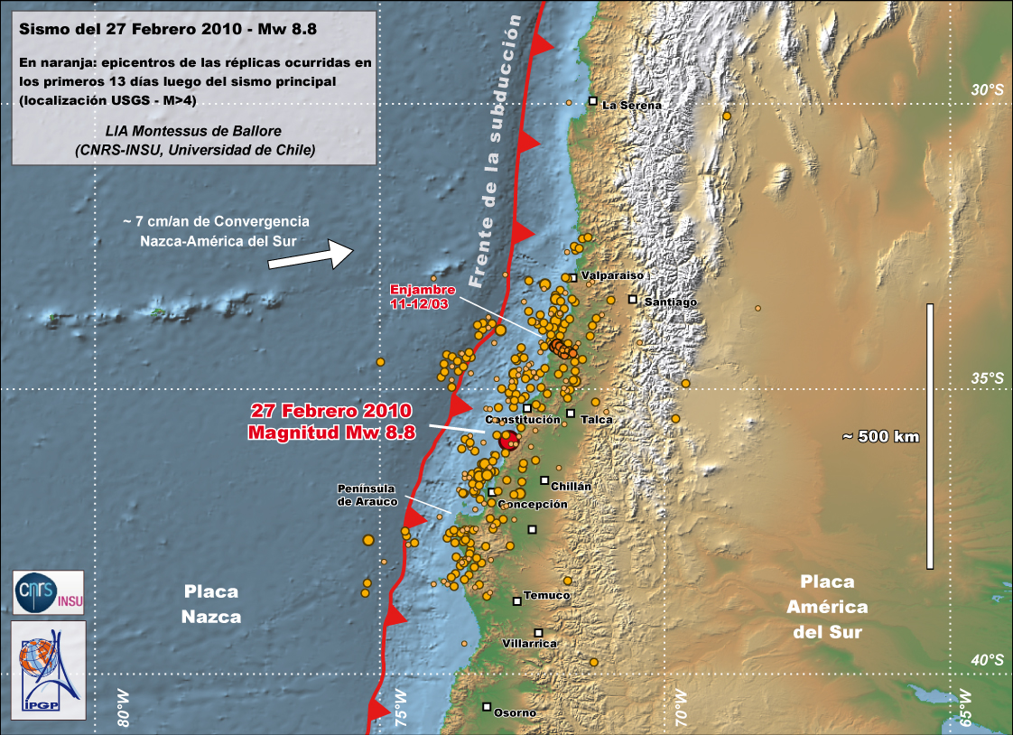
- Earthquake maps in SPANISH : Epicentros des las réplicas (primeros 13 días) - Zonas de ruptura de los sismos mayores con replicas
Higher resolution versions of some of these figures are available from this repertory.
Please give an adequate reference while using these maps, such as :
" map by LIA Montessus de Ballore (CNRS-INSU and Univ. de Chile) and IPGP tectonics lab (R. Lacassin) "
Page by Robin LACASSIN - Equipe Tectonique, Institut de Physique du Globe de Paris (IPGP)