The Andes - WAT
Robin Lacassin
Directeur de recherche CNRS
Tectonique - IPGP
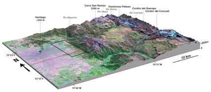
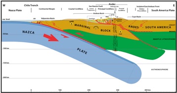
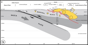
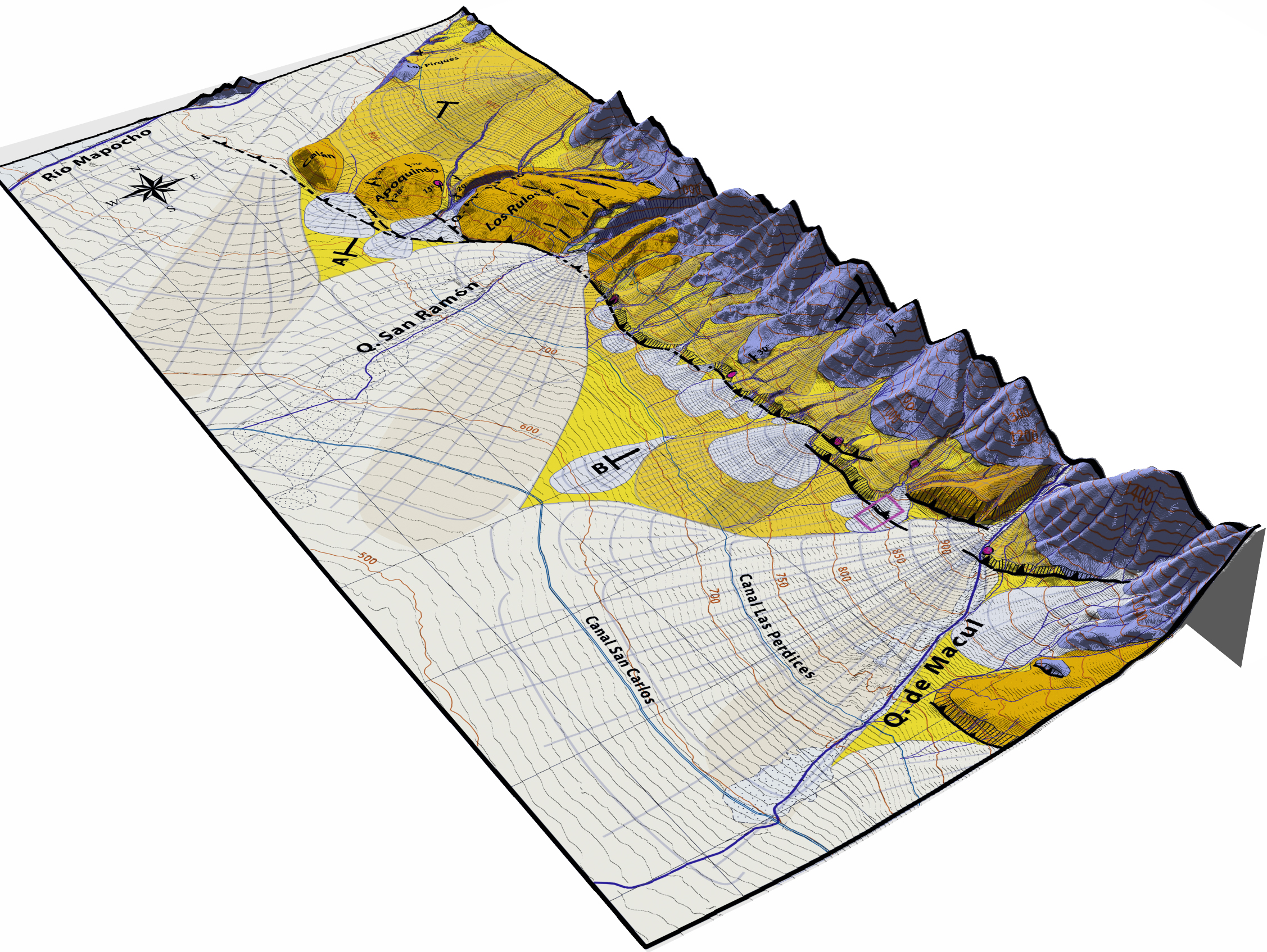
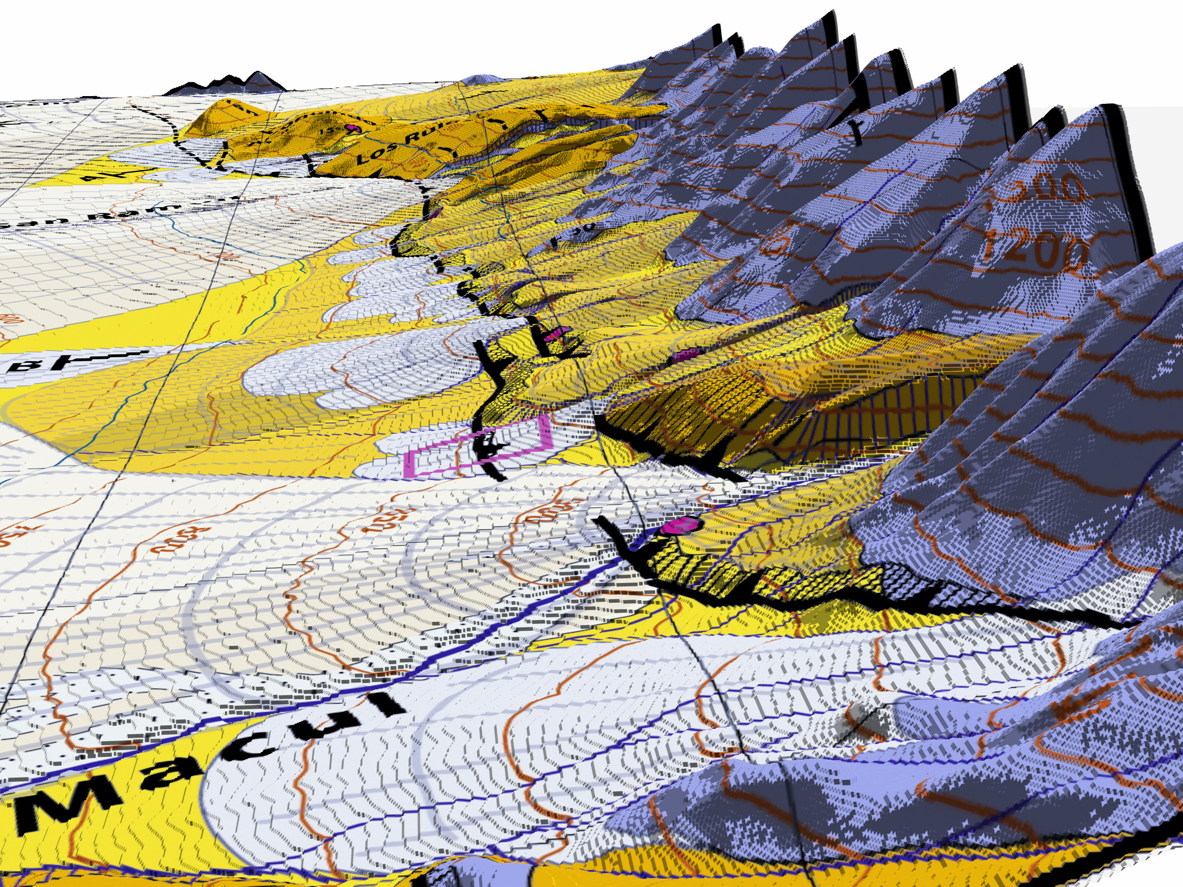
The importance of west verging structures at the western flank of the Andes, parallel to the subduction zone, appears currently minimized. This hampers our understanding of the Andes‐Altiplano, one of the most significant mountain belts on Earth. We analyze a key tectonic section of the Andes at latitude 33.5°S, where the belt is in an early stage of its evolution, with the aim of resolving the primary architecture of the orogen. We focus on the active fault propagation–fold system in the Andean cover behind the San Ramón Fault, which is critical for the seismic hazard in the city of Santiago and crucial to decipher the structure of the West Andean Thrust (WAT). The San Ramón Fault is a thrust ramp at the front of a basal detachment with average slip rate of ∼0.4 mm/yr. Young scarps at various scales imply plausible seismic events up to Mw 7.4.
The WAT steps down eastward from the San Ramón Fault, crossing 12 km of Andean cover to root beneath the Frontal Cordillera basement anticline, a range ∼5 km high and >700 km long. We propose a first‐order tectonic model of the Andes involving an embryonic intracontinental subduction consistent with geological and geophysical observations. The stage of primary westward vergence with dominance of the WAT at 33.5°S is evolving into a doubly vergent configuration. A growth model for the WAT‐Altiplano similar to the Himalaya‐Tibet is deduced. We suggest that the intracontinental subduction at the WAT is a mechanical substitute of a collision zone, rendering the Andean orogeny paradigm obsolete.
The West Andean Thrust (WAT), the San Ramón Fault and the seismic hazard for Santiago (Chile)
Armijo et al., Tectonics, 2010
Useful Files - Maps - Figures
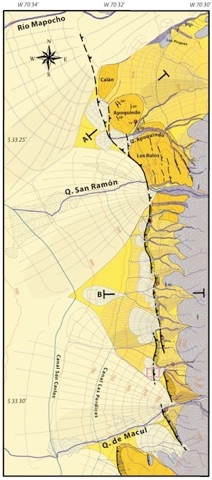
KMZ File to display a raster image of the San Ramón Fault map in Google Earth.
KMZ File with the trace of the San Ramón Fault represented as on Figure 4 of the paper
Zipped shape file : geocoded vector trace of the San Ramón Fault, separated into two groups (trace observed directly and trace inferred with confidence from the morphology). Projection is WGS84 UTM19S.
links to useful files and figures at bottom of the page
download Reply to comment by Astini and Dávila
Please refer to the published paper and to this page while using auxiliary files and figures.
updated March 2011