Subsidence at Campi Flegrei (Italy) detected by SAR interferometry
Antonio Avallone, Pierre Briole, Christophe Delacourt, Aldo Zollo, and François Beauducel
Geophysical Research Letters, vol. 26, n° 15, 2303-2306, August 1, 1999.
|
Subsidence at Campi Flegrei (Italy) detected by SAR interferometry
Antonio Avallone, Pierre Briole, Christophe Delacourt, Aldo Zollo, and François Beauducel |
Abstract. Seven ERS SAR images of the Napoli area acquired from 1993 to 1996 were used to create six interferograms. Although the altitude of ambiguity of the selected couples is high, the interferograms exhibit a relatively low level of coherence, even for couples sampling short time intervals. There is no clear relation between coherence of the interferograms and sampled time interval nor with the season of image acquisitions. No deformation is observed on Vesuvio volcano. The best interferogram, corresponding to the period February 14, 1993 - April 3, 1996, shows that the centre of the Campi Flegrei caldera, near Pozzuoli harbour, subsided by about three fringes (84 mm) during the three years interval. This result is consistent with the value of 32 mm/year obtained from routine levelling surveys over the same period in the same area. The deflation that started after the 1983-84 seismic and inflation crisis is thus still significant. The modelling of the fringe pattern, assuming a spherical deflating source within an elastic half-space medium, predicts a source centred 700 m Southwest of Pozzuoli at a depth of 2.7 km. For the studied time window, the modelled volume decrease at depth is 0.8 × 10⁶ m3/year and the maximum subsidence predicted by the model is 25 mm/year.
Download the re-print paper (© AGU 1999GL900497): ![]()
![]()
See also the related paper: [Briole et al., 1999]
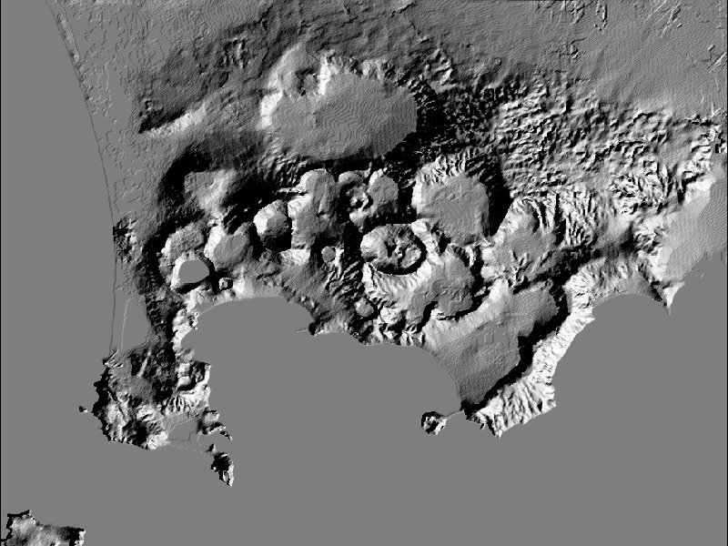 |
Click on this image to see a topography map of Campi Flegrei area (800x600 pixels). |