Photogrammetry : Decennial Geomorphic Transport From Archived Time Series Digital Elevation. A cookbook for tropical and alpine environments Models
DOI : 10.1109/MGRS.2021.3121370
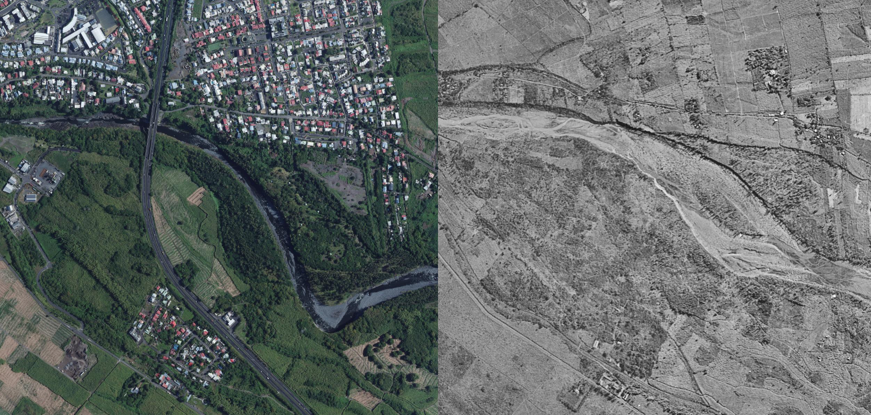
On the seasonal time scale, for accessible locations and when manpower is available, direct observations and field survey are the most useful and standard approaches. However very limited studies have been conducted on direct observation at the decennial to century time-scale due to observational constrains. Here, we present an open and reproducible pipeline based on historical aerial images (up to 70 yrs time span) that includes sensor calibration, dense matching and elevation reconstruction over two areas of interest that represent pristine examples for tropical and alpine environments. The Remparts Canyon and Langevin River in Reunion Island, and the Bossons glacier in the French Alps share a limited accessibility (in time and space) that can be overcome only from remote-sensing. We reach a metric to sub-metric resolution close to the nominal images spatial sampling. This provides elevation time series with a better resolution to most recent satellite images such as Pleiades over decennial time period.
The ConCone Algorithm : Volcanic island multi-stage construction inferred from a simple geometrical approach: Example of Réunion Island
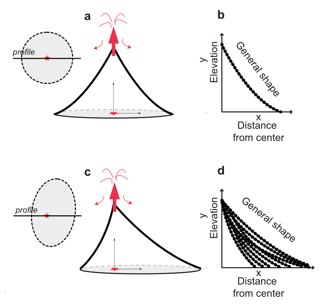
The reconstruction of volcanic landforms is an effective way to assess the construction history and growth rates of volcanic structures and is a useful tool to estimate erosion rates. We propose a simple geometrical approach to reveal the location of the long-term eruption centers and the general shape of eroded volcanoes within the altitudinal range of the input data. This DEM-based approach consists of finding the radial topographic profile of an eroded volcanic landform from its remaining surfaces, by coupling two independent and simple mathematical methods (linear regression and Spearman rank correlation). Here we demonstrate that this simple approach is suitable for circular to elliptical (up to an ellipticity of 0.5) and to some extent for asymmetrical volcanoes, and we apply it to Réunion Island. Our results confirm previous conclusions from geological observations and data requiring more complex instrumentation. We confirm that the center of long-term volcanic activity of Piton des Neiges remained stable for the past 1.4 Myr while Piton de la Fournaise has been migrating eastward for ~300 kyr. Our approach also reveals that Piton des Neiges is the dominant volcano in Réunion and that Piton de la Fournaise is a smaller edifice built on its edge. Moreover, despite the contribution of two other volcanoes in the construction of Réunion, we suggest that the Piton des Neiges has rapidly become the main structure of the whole island and has subsumed the previous volcanic centers . Finally, we use our approach to model the magmatic activity of Piton des Neiges, and suggest a deceleration of its magma emission rate since 2Myrs.
ConeCone is available at https://github.com/egayer/conecone