Mapping Mantle Wedge Seismicity for seismic Hazard Assessment: The Lesser Antilles Subduction Zone Case
23/05/2025
IPGP - Îlot Cuvier
14:00
Séminaires de Sismologie
Salle 310
Océane Foix
Univ. Grenoble Alpes
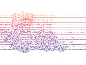
The forearc mantle wedge has long been considered unsuitable for earthquake nucleation due to its physical properties. With advances in seismic instrumentation, some cold subduction zones have revealed seismic clusters within this region (e.g., Greece, Japan, New Zealand, Lesser Antilles - LA). The maximum earthquake magnitude potential in the mantle wedge remains unknown. In the LA, this seismicity is located approximately 50 km east of the French island coasts, at depths of 25 to 60 km. The 1974 earthquake (M = 6.9-7.5) is estimated to have occurred just below the current Moho depth. The limited azimuthal coverage of the seismic network makes the characterization of mantle wedge seismicity as seismic source challenging. By analyzing secondary phases in local earthquake waveforms, we can achieve more robust source region identifications. We extracted 15 earthquake waveforms to be analyzed and used as references for the central LA mantle wedge seismicity. We are currently using this database to analyze 778 earthquakes, which we have identified as potential mantle wedge events based on subduction geometry. As part of the Atlas project for the LA seismic hazard reassessment, we will use our catalog to estimate the a- and b-values, and assess the impact of this seismicity on ground motion.
Zoom link:
https://cnrs.zoom.us/j/92479299685?pwd=O7ZjLSCoIWd9Ko1NuFy50k584NLT4s.1
Meeting ID: 924 7929 9685
Passcode: ndRj1X