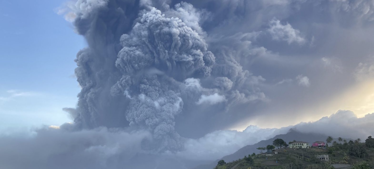
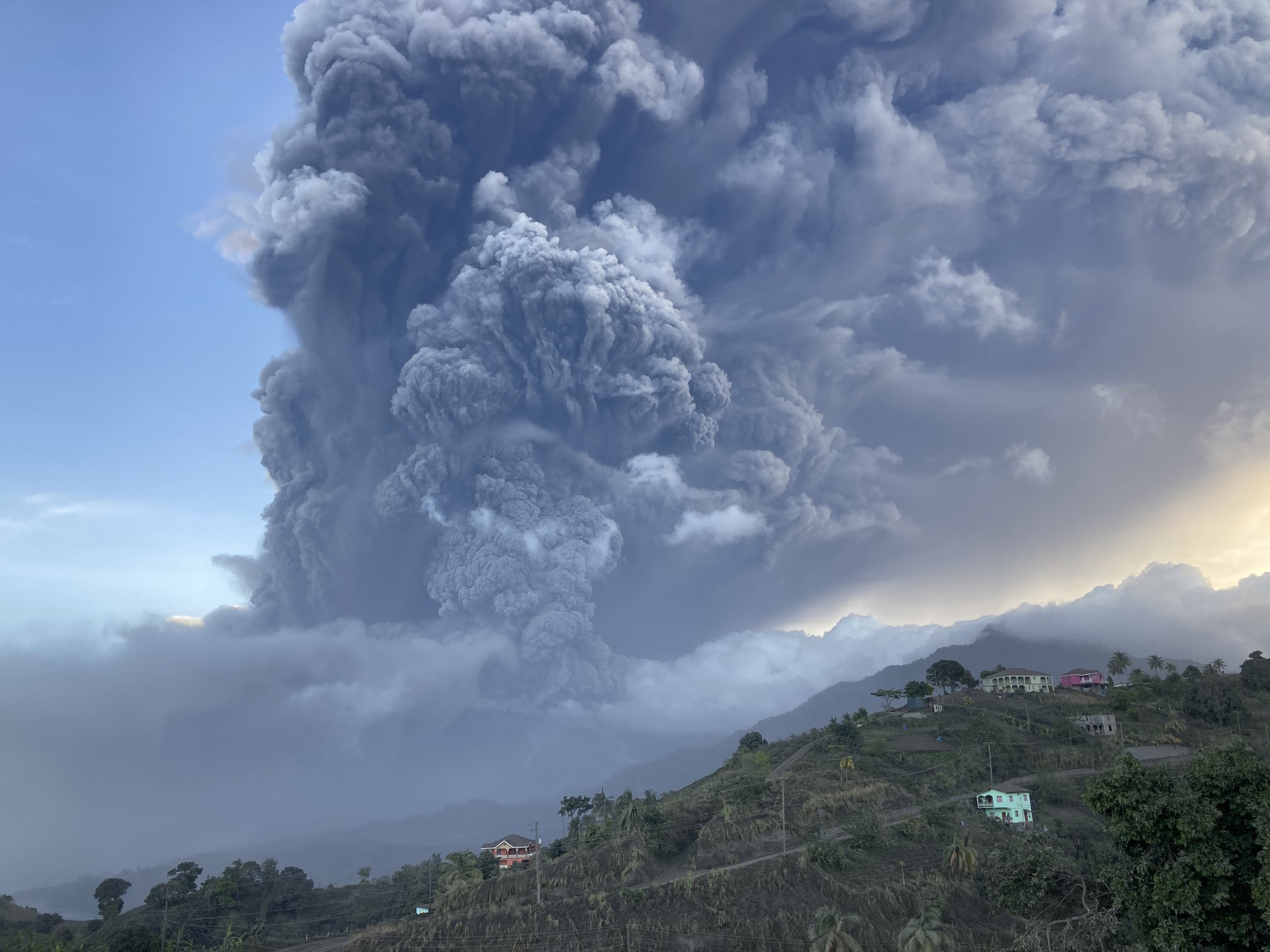
On April 9th, at 8.41am local time, the volcano entered a major explosive phase, producing a column of ash and gas around 8km high, followed by a second explosion at 2.45pm local time, this time with a higher column. Evacuations, complicated by the health crisis, continued in parallel throughout the day. Explosive episodes occurred every two hours or so on April 10th , then every 3-4 hours on April 11th. In all, at least 30 explosions were recorded between 9 and April 16th, with column heights reaching 20 km. By April 11th, the entire island of Saint-Vincent was covered in volcanic ash dispersed by the successive eruptive columns. High wind speeds carried the ash rapidly towards the Atlantic Ocean, affecting the island of Barbados from April 10th onwards (dark skies, ash falls), as well as the island of Saint Lucia to the north, and even Martinique slightly, where a few mm of ash were reported by the inhabitants of the south of the island from April 12th onwards.
See the detailed chronology of the eruption below.
How is this eruption being studied? What can we learn from it and how will it evolve?
This type of explosive eruption is much more dangerous than an effusive eruption such as that seen at Piton de la Fournaise. Direct observations and measurements on the ground are therefore difficult during the eruption, so we are monitoring this eruption mainly from a distance, using satellite data. These provide a wealth of information on the occurrence of explosions, the maximum height of the column, the direction and distance of dispersion of volcanic products, and the quantity of ash and volcanic gases (particularly sulphur) injected into the atmosphere. Very high-definition radar images have also made it possible to see through the eruptive column and to observe the total disappearance of the two lava domes (the one from 1979 and the one from 2020-2021) in the large summit crater (caldera), which have given way to an enormous crater.
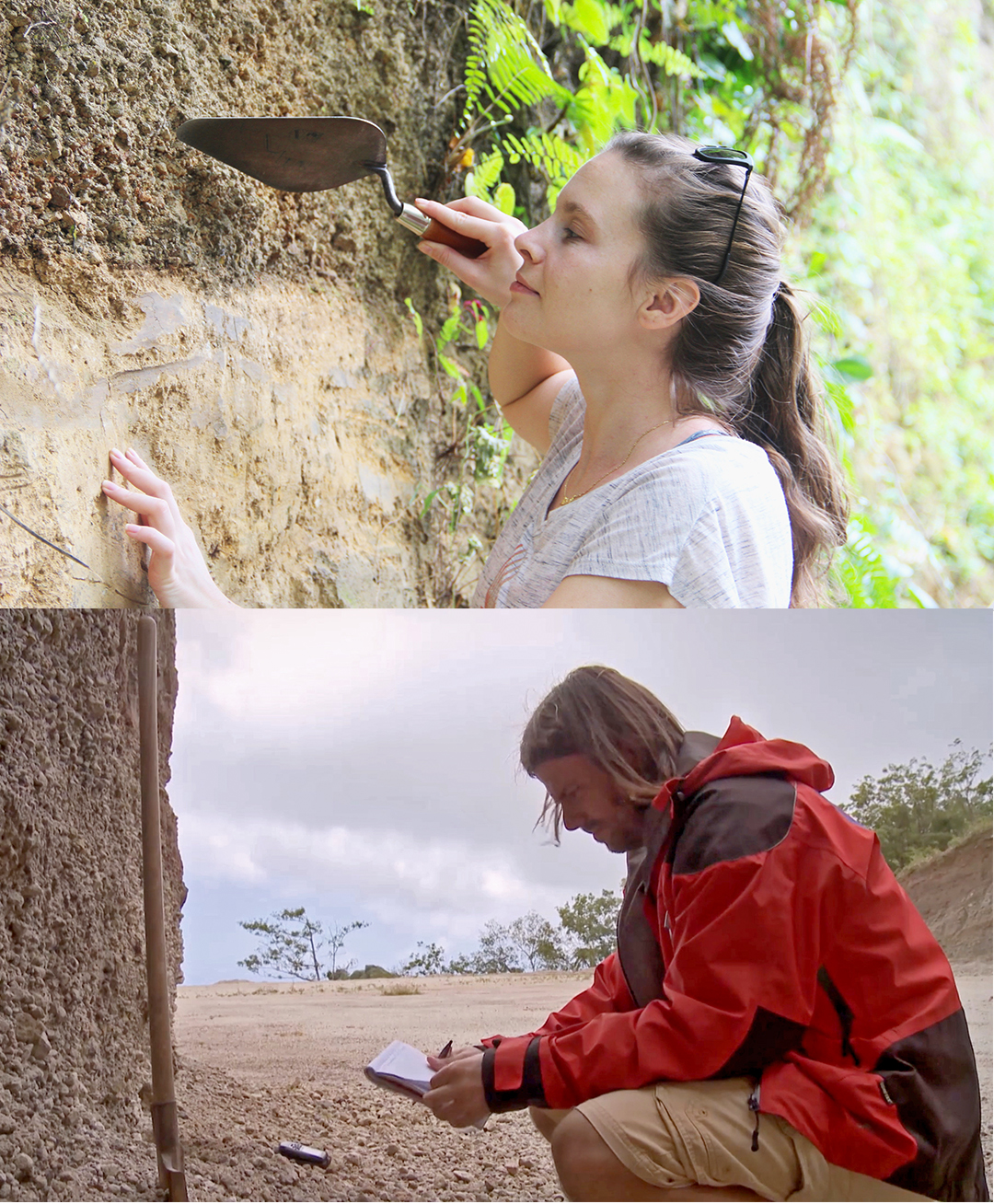
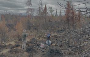
The scientists on site are making as many direct observations as possible, such as measuring the thickness of deposits and taking ash samples to find out more about the magma that fed the eruption. Once the eruption is over, more in-depth field studies will be carried out on the volcano to reconstruct in detail the chronology and volume of the eruption.
This real-time monitoring of the eruption is vital, first and foremost for adapting air transport. It has also enabled us to quantify the mass of sulphur emitted (which had already reached over 200 kT by 10 April), and to get an initial idea of the volume of ash ejected. The latter indicates that this eruption could already be classified as VEI4 (VEI = Volcanic Explosivity Index), making it an eruption of the same order of magnitude as that of Eyjafjallajökull in Iceland in 2010. These estimates will be refined as the eruption progresses. The quantity of sulphur emitted, for example, is an important parameter because it is an indicator of the potential climatic impact that this eruption could have.
It is impossible to know precisely how much longer the Soufrière of Saint-Vincent will continue to erupt, but based on its past eruptive history, it is possible to envisage explosive activity continuing for several more days, or even weeks. Then, the eruption could stop or continue for a few more weeks/months as a new lava dome is built. The scenario of magma recharging and renewed explosive activity cannot be ruled out either. Ongoing monitoring of seismic recordings, deformation measurements and gas measurements will continue to provide more precise information on a daily basis.
Could this eruption have consequences for other volcanoes in the Antilles (particularly those in Martinique and Guadeloupe)?
This eruption is already having an impact on the other islands in the Caribbean arc, due to the fallout of ash from the successive eruptive columns produced by the Soufrière of Saint-Vincent. But there is no risk that the current eruption of the Soufrière in Saint-Vincent will trigger others in Martinique or Guadeloupe. The collective memory of the May 1902 eruptions of La Soufrière de Saint-Vincent and Montagne Pelée, which occurred just over 24 hours apart, is still fresh in everyone’s minds, but this is the only time in their respective eruptive histories (over 100,000 years old) that these volcanoes have erupted at the same time. We now have a good idea of the location, geometry and functioning of the magma storage zones beneath each volcano in the Caribbean arc. We can therefore state that these volcanoes are not linked to each other. There is therefore no cause and effect relationship between the eruptive activity of one volcano and the behaviour of a volcano on a neighbouring island.
Chronology of the eruption of La Soufrière de Saint-Vincent (sources SRC, UWI):
- end of December 2020: appearance of a lava dome in the summit crater
- December 27th 2020: first photograph of the lava dome
- March 19th 2021: the lava dome reaches a volume of 13 million m³.
- March 23th 2021: a change in seismic activity is detected
- March 23th to 26th 2021: crisis of volcano-tectonic earthquakes (VTs, interpreted as the result of rock fracturing) located 5-10 km below the volcano and sometimes felt by the population
- from April 5th: detection of new VTs
- April 8th 2021: detection of tremor episodes (corresponding to fluid movements), strong gas emanations and accelerated growth in height of the new lava dome
- April 8th 2021: Orange alert (preparation for an evacuation that could be imminent) at the end of the morning. The alert is then raised to red and the evacuation of around 13,000 residents in the red “volcanic hazard” zone begins.
- April 9th, 8:41 am local time: start of the explosive phase with the production of a column of ash and gas around 8 km high
- April 9th, 14:45 local time: a second explosion producing a higher column
- April 9th, all day: evacuations continue, complicated by the health situation
- April 10th, 11th, 12th and 13th : Explosive episodes followed one another every two hours or so on 10 April, then every 3-4 hours on April 11th. In all, at least 27 explosions were recorded between April 9th and 13th, with column heights of up to 20 km. Partial collapses of the column triggered pyroclastic flows that swept down the volcano’s slopes and channelled into deep valleys, reaching the sea on several occasions.
- April 18th, 16:49 local time: an explosion (at least the 31st) occurs after 52 hours without any significant explosive activity.
- April 22nd, 11.08am local time: an explosion (at least the 32nd) occurred after almost 4 days with no significant explosive activity despite periods of ash emission; it generated a new dilute and turbulent pyroclastic flow which descended the northern flanks of the volcano.
- On April 23rd, the eruption continued with seismic activity that was still significant and characteristic of lava dome growth/destruction cycles, suggesting that the formation of a new lava dome had resumed in the crater.
Sources and additional information: