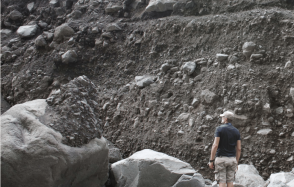
The region affected by this earthquake is desert, so the outcrop conditions are particularly good for documenting surface ruptures. During an earthquake, displacement along the fault is accommodated by rupture of the fault segments, but also by diffuse deformation of the surrounding materials. To better understand these deformation mechanisms associated with the seismic rupture process, observations of surface ruptures are essential.
However, in the case of the Ridgecrest sequence, the rupture is essentially located in a desert zone with very few human settlements, so the number of markers for measuring deformation in the field is very limited. It is also a military zone with restricted access.
Thanks to an active collaboration with CNES, via the optical satellite image acquisition cell in the context of telluric events (CIEST), an IPGP team was able to rapidly acquire multi-stereo coverage of the entire rupture zone using the Pleiades imager, with a ground resolution of 50 cm. Using the Micmac open-source tool (developed in partnership between IGN and IPGP), these images were then correlated with archive images from different satellite sensors, Pleiades and Worldview, to produce horizontal and vertical ground displacement maps with a resolution of 50 cm.
These maps were used to establish the surface slip curve associated with this earthquake. Unlike field measurements, this method is not dependent on the existence of specific markers on the ground and it is therefore possible to obtain a homogeneous measurement everywhere along the seismic rupture.
As well as providing a complete measurement of the displacements along the seismic rupture, this technique enables a direct assessment of the distributed horizontal deformations (Off-Fault Displacement, OFD) in a zone a few hundred metres to a kilometre wide around the fault. This component of the deformation is virtually impossible to quantify by any other means.
By carrying out this measurement for the Ridgecrest earthquake, a study carried out by a team from the IPGP, the CNRS, the University of Paris and their colleagues from the University of California and the US Geological Survey, published in the October 2021 volume of the Bulletin of the Seismological Society of America, shows that this distributed deformation can account for up to 30% of the total deformation generated by the earthquake. This deformation is distributed in the volume surrounding the fault zone but contributes to the total deformation budget, which goes a long way towards answering questions about the possible existence of a slip deficit when the rupture reaches the surface. This measurement shows that, very probably, if this deficit exists, it is actually very small, but that the deformation is not necessarily localised when it reaches the surface.
This new data drastically changes the outlook for assessing cumulative displacement for geomorphological objects that have been affected by multiple earthquakes, and also for ground displacement in terms of assessing the hazard associated with this displacement for a given earthquake (Fault Displacement Hazard Assessment).
Réf : Antoine S., Klinger Y., Delorme A., Wang K., Burgmann R., Gold R. Diffuse deformation and surface faulting distribution from submetric image correlation along the 2019 Ridgecrest, California, ruptures. Bull. Seismol. Soc. doi: 10.1785/0120210036, 2021.


