Citizen / General public
Researcher
Student / Future student
Company
Public partner
Journalist
Teacher / Pupil

“Tellus Mayotte” seismic mission at sea

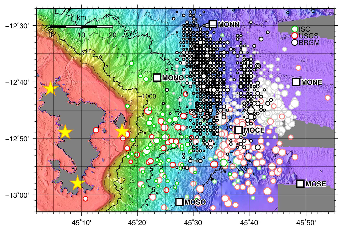
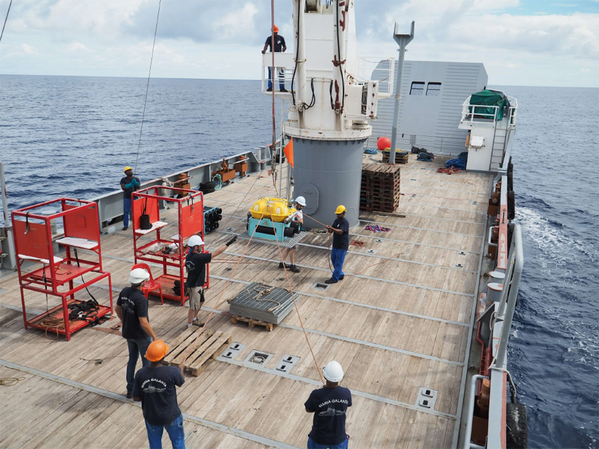
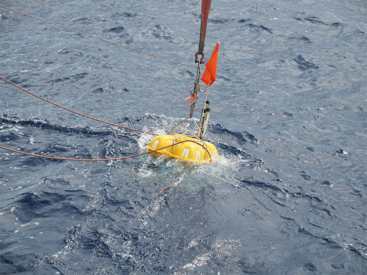
The call for proposals, entitled "Tellus Mayotte", launched at the end of 2018, and comprising three major operations, two on land (Mayotte and Glorieuses) and one at sea, resulted in the selection of the partnership of several French research institutes (IPGP/IPGS/BRGM/LIENs/ISTerre/IFREMER). The mission described below corresponds to the first phase of the offshore mission. It was made possible thanks to the mobilisation of the cargo ship YLANG belonging to the Société de Gestion et de Transports Maritimes, which enabled the measurement equipment to be dropped at sea.

“Tellus Mayotte” seismic mission at sea

Publication date: 22/02/2019

Observatories, Press, Research

The team of scientists involved is made up of three members of the INSU-IPGP seabed seismometer national park team (Wayne Crawford, scientific manager, Romuald Daniel, technical manager and Simon Besançon, OBS engineer), accompanied by Jean-Frédérique Béart, technical manager of the boat hire company, and Caroline Mauduit, head of the Natural Hazards department of the Department of the Environment, Planning and Housing (DEAL).

White squares: OBS (Ocean Bottom Seismometer) measuring devices deployed between 20 and 65 km east of Mamoudzou / Yellow stars: onshore broadband seismometers soon to be deployed / Green, red and black circles: seismic foci identified by the various networks.

Positioning the measuring equipment

The choice of location for the measuring instruments was based on several parameters:

  • support for the calculated location of earthquake sites using the various measurement networks, with 6 devices complementing the onshore observation network,
  • Positioning in relation to the bathymetry of the ocean floor, in particular to ensure that the instruments were placed in flat areas sheltered from areas of marine sediment movement, identified by processing maps of the slopes of the ocean floor.

Releasing the OBSs

The probes were released one after the other at the surface of the ocean, reaching their estimated theoretical position at a depth of between 1,600 m and 3,520 m. The 6 OBSs were dropped between 22:20 (local time) on 23 February and 14:44 (local time) on 25 February. A crane was used to launch the OBS over the water. A mechanical release system then detaches the system from the crane once the precise position has been reached by GPS positioning of the boat.

OBS handled by a crane, then dropped into the water

Data processing

Data analysis, which will be possible once the OBSs have been recovered, should make it possible to validate the hypotheses about the origin of the tectonic/volcanic phenomenon, but also to specify the dimensions of the supposed phenomenon and the location of the earthquakes (a single focus or several foci, the distance of the foci from Mayotte, etc.). It will also be able to highlight magma migration processes through conduits (chimneys, veins) and specify whether the magma sources are deep or more superficial.

This information will provide a better understanding of the swarm of earthquakes that have been occurring since May 2018, and therefore a better assessment of the risks to the population of Mayotte, particularly through a better estimate of the spatio-temporal changes in the distribution of earthquakes.

Slope map in degrees from bathymetry. For the OBS MONO deployed on the surface at the level of the grey disc, a calculation programme fed by the travel times of the acoustic waves, for the 5 surface locations, indicates that the OBS arrived at the seabed at the location represented by a black square, i.e. with an offset of 280 m to the North-North-East.

In particular, the measurements will make it possible to confirm or reject the hypothesis of a fault network created in a zone of tectonic accommodation between the East African rift and the boundary region between the African, Indian and Somali plates. The data could also be used to validate Mayotte’s regional seismicity zone (moderate zone, level 3 out of 5), and it is likely that lessons could be learned about the formation of the Comoros archipelago.

Latest news
Jérôme Vergne becomes the new Director of the OVSM-IPGP
Committed to the various aspects of observing and monitoring telluric phenomena, Jérôme Vergne joined the IPGP on 1 July 2024 as Director of the Volca...
Evidence of magmatically induced faults at the East Pacific Rise
By comparison of ultra-high-resolution 3-D seismic imagery and bathymetry data collected at the East Pacific Rise (EPR) 9º50'N, researchers reveal the...
Charles Le Losq appointed member of the Institut Universitaire de France
The role of the Institut Universitaire de France (IUF) is to encourage the development of high-level research in universities and to strengthen interd...
NASA will measure earthquakes on the Moon using technologies developed for the InSight mission on Mars
The technology of the two seismometers that are part of NASA's Farside Seismic Suite instrument has detected more than a thousand earthquakes on the R...