Citizen / General public
Researcher
Student / Future student
Company
Public partner
Journalist
Teacher / Pupil

Earthquakes and volcanoes in Mayotte: conclusions of the last two sea campaigns

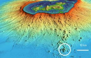
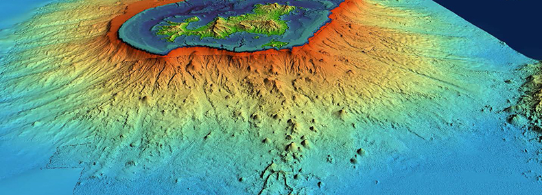
The MAYOBS 3 and 4 campaigns identified a new lava flow and produced the first images of the seabed. Meetings and debriefings with the various stakeholders in Mayotte also took place on board the Marion Dufresne.

Earthquakes and volcanoes in Mayotte: conclusions of the last two sea campaigns

Publication date: 02/08/2019

Observatories, Press, Research

Related themes : Natural Hazards

The last two oceanographic campaigns, “MAYOBS3” and “MAYOBS4”, funded as part of a knowledge acquisition programme by the Ministry of Ecological Transition and Solidarity and the Ministry of Higher Education, Research and Innovation, came to an end on Wednesday July 31st. To mark the occasion, a scientific presentation took place on board the oceanographic vessel Marion Dufresne, organised in two stages: firstly, a morning discussion between the scientists and the various stakeholders in Mayotte (members of parliament, elected representatives from the Departmental Council, mayors, experts, members of the pre-selection committee for the volcano’s name); secondly, a press conference in the afternoon.

These meetings were part of the government’s drive to ensure the transparent dissemination of scientific knowledge and to promote understanding of the phenomenon by enabling the public to take ownership of it. They provided an opportunity to showcase the data collected during the MAYOBS campaigns and to explain the collective work carried out by scientists from the French Research Institute for Exploitation of the Sea (Ifremer), the Geological and Mining Research Bureau (BRGM), the National Centre for Scientific Research (CNRS), the French National Institute for Geophysical Research (CNRS), the French National Institute for Geophysical Research (CNRS), the French National Institute for Geophysical Research (CNRS) and the French National Institute for Geophysical Research (CNRS), Centre National de la Recherche Scientifique (CNRS), Institut de Physique du Globe de Paris (IPGP) and Institut de Physique du Globe de Strasbourg (IPGS), Université de La Réunion and Université de Clermont Auvergne, under the direction of Nathalie Feuillet (IPGP), Yves Fouquet (Ifremer) and Isabelle Thinon (BRGM).

The aim of the MAYOBS3 mission was to recover some of the seabed seismometers that monitor the area, before they are redeployed in September 2019. The seismometers remaining on the seabed will enable monitoring to continue.

The MAYOBS3 and MAYOBS4 campaigns mapped the volcanic rift between the active volcano (around 50 km from the island) and the seismic zone (around 15 km from the island).
Seismicity has decreased. The earthquakes are deep (20 to 50 km). Deep earthquakes have also been located between the main seismic zone (15 km from the island) and the land. They have been present since the beginning, but were not located during previous missions because of their low magnitude (between 1 and 3).

A new flow identified

The data collected confirms that the height of the volcano has not changed (summit at a depth of 2850 metres). However, since June, a new volcanic flow has been identified on the western flank of the submarine volcano. It is more than 150 metres thick. The estimated volume is 0.3 km3.

The “MAYOBS3” and “MAYOBS4” campaigns also detected fluid emissions and plumes of volcanic origin. These plumes do not reach the surface. The plumes detected at the top of the new volcano in May and June no longer exist, while smaller plumes have been detected on the new flow.

The first images of the seabed

Two scampi dives (camera close to the bottom) were carried out on the volcano. They show pillow lavas and corded lavas typical of more fluid lavas. Fluid samples were taken from the plumes; analyses are currently underway.

Rock samples were taken from recent flows using four dredges.

The MAYOBS campaigns have therefore yielded a wealth of data. The scientific teams will continue to analyse this data on land to gain a better understanding of the potential risks associated with these seismic-volcanic phenomena.

For further information:

Latest news
Discovery of CO₂ hydrates off the coast of Mayotte: a unique site for studying carbon storage in the ocean
More than 120 CO₂ hydrate deposits were discovered at the Fer à Cheval site, 10 km east of Petite Terre (Mayotte), during the Geoflamme campaign co-le...
Publication of the IPGP 2025 Annual Report
The IPGP Annual Report, published in both French and English, aims to share with the widest possible audience our enthusiasm for the research carried ...
SOUFRIÈRE_50: a week to revisit fifty years of scientific progress and meet the challenges of 21st-century volcanology
Press Release - Fifty years after the 1976–1977 eruption of La Soufrière de Guadeloupe—an event that left a profound mark on Guadeloupe, as well as on...
QVCT Week is back at the IPGP from 15 to 19 June 2026!
For the second year running, Quality of Life and Working Conditions Week (QVCT) is back at the IPGP. It’s an opportunity to strengthen bonds between c...