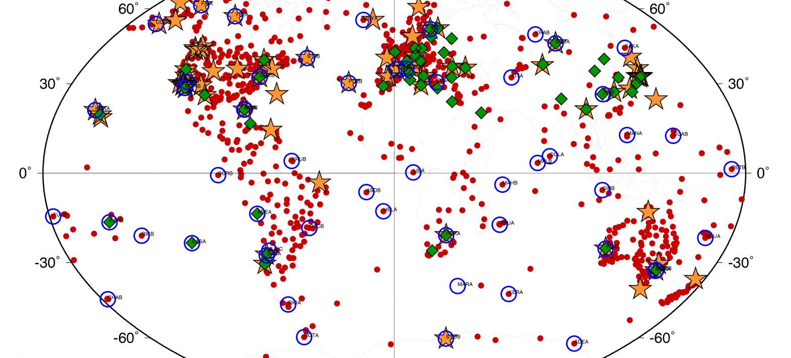
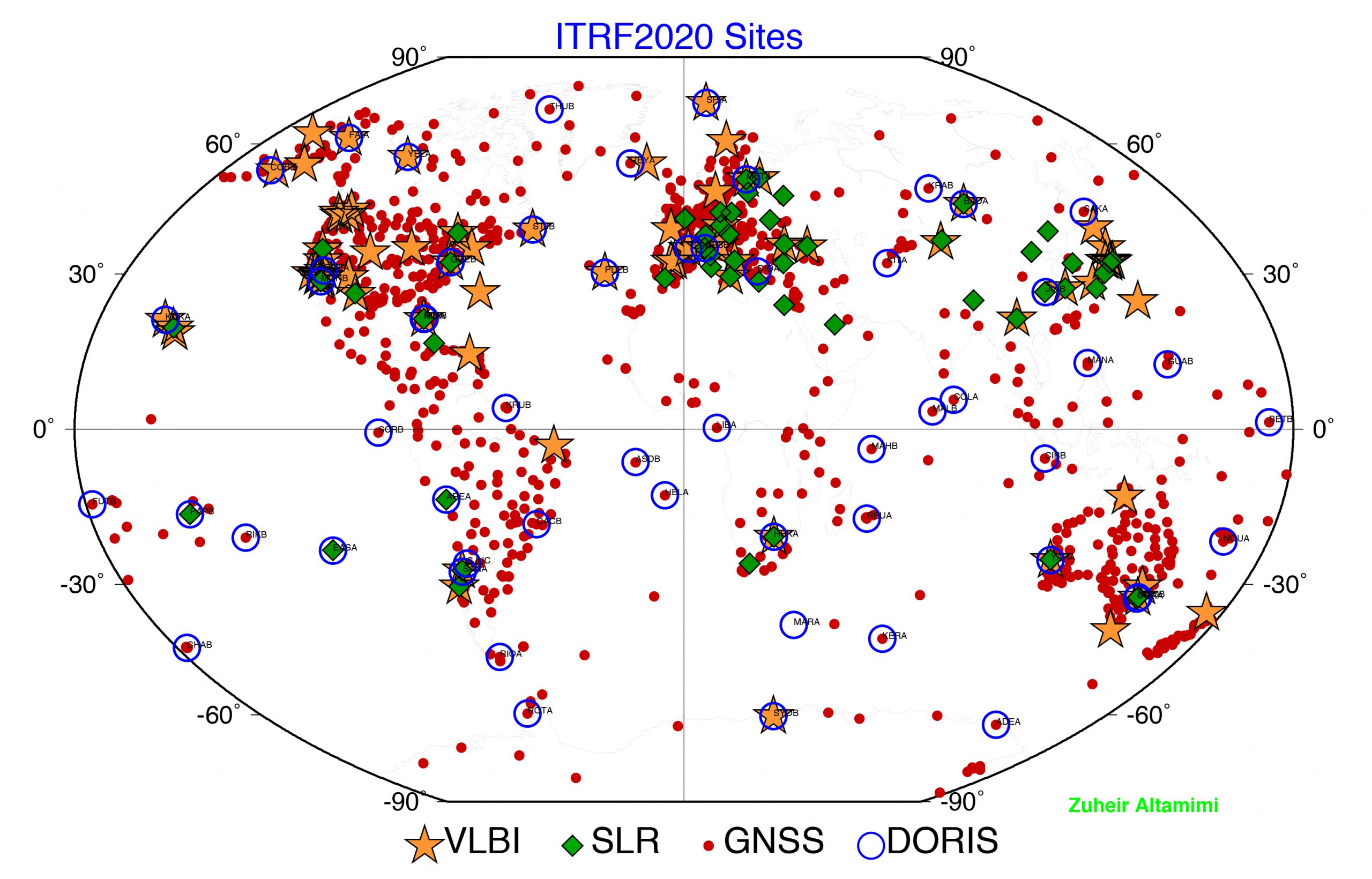
Publication of the new international terrestrial reference system
Zuheir Altamini, head of the team that calculates and publishes the new ITRF benchmark, and a geodesy researcher at IGN and IPGP, talks about the importance of a common international reference that reflects the constant evolution of our planet's surface.
Publication date: 23/05/2022
Press, Research
Related teams :
Geodesy
Related themes : Earth and Planetary Interiors
Latest news