Citizen / General public
Researcher
Student / Future student
Company
Public partner
Journalist
Teacher / Pupil

Study of the unstable zones around the Dolomieu crater and assessment of the risks for visitors

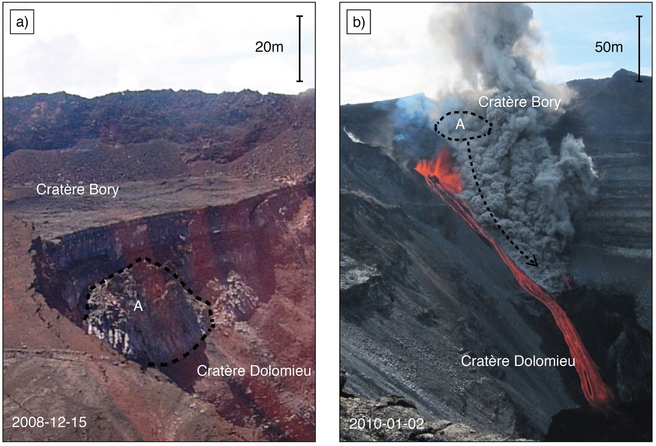
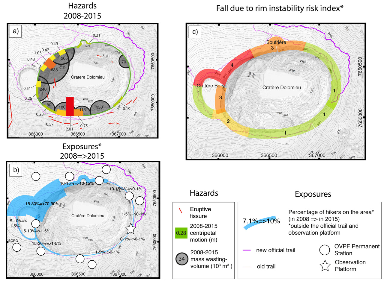
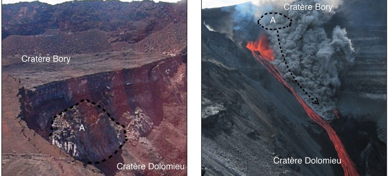
In April 2007, the morphology of the summit of Piton de la Fournaise changed radically. Its main crater, the Dolomieu, previously filled to the rim with a field of lava from successive summit eruptions, collapsed in the space of a few days into an abyss around 300 metres deep.

Study of the unstable zones around the Dolomieu crater and assessment of the risks for visitors

Publication date: 30/10/2018

Observatories, Press, Research

Related themes : Natural Hazards

Illustration of instantaneous collapse of part of the Dolomieu rim (a) Aerial photograph taken on December 15th 2008 showing the interior of the western edge of the Dolomieu (© F. Massin). (b) Photograph of the collapse of structure (A) during the eruption of January 2nd 2010 (© A. Di Muro).

Located on the island of Réunion, off the coast of Madagascar, this volcano is one of the most active and visited on our planet. As the collapse of the volcano widened and destabilised the contours of the Dolomieu crater, the path that allowed visitors to walk around it prior to 2007 was closed by order of the prefect and a new route taking hikers to a secure observation platform was created.

Despite this, many people still attempt to walk around this impressive geological curiosity. In order to quantify the risk of sudden destabilisation of the crater rim for these visitors, the OVPF (Observatoire volcanologique du Piton de la Fournaise) carried out high-resolution aerial photography campaigns on the summit of the volcano from 2008 to 2015.

The geodetic data from these campaigns has enabled us to map the unstable zones very precisely (to within a few tens of centimetres) and measure their movement over time. Over a period of 7 years, certain well-defined parts of the rim moved by 50cm to 2m towards the centre of the crater and eventually broke away, producing major collapses that instantly pushed back the edge of the Dolomieu by several tens of metres. These collapses, located mainly to the north-west, have accelerated since the resumption of activity in 2014.

The data from these campaigns confirms that the observation platform, located to the east of the summit crater, rests on one of the least unstable zones and that the edge of the Dolomieu is still subject to frequent collapses, and even more so in 2014-2015 than between 2008 and 2014.

Determination of the risk of destabilisation of the rim of the Dolomieu crater. (a) Zonal hazards, showing the movement of different parts of the rim towards the centre of the crater over the period 2008-2015 (b) joint determination of vulnerability (location of visitors to the "tour of the craters" - excluding the population only visiting the platform - in 2008, then in 2015) (c) cross-analysis of the level of risk. Level 1 (green) corresponds to areas with less than 1% visitor numbers in 2015 or less than 0.1m movement. Level 2 (yellow) concerns areas with 1 to 5% walkers and between 0.1 and 0.5m of movement. Parts of the edge with between 5 and 15% visitors and 0.1 to 0.5m of deformation or 1 to 5% and 0.5 to 1m fall into risk level 3 (orange). Finally, level 4 (red) corresponds to areas that are very busy (>50%) and very unstable (more than 1m of movement).

Ref: Multi-temporal airborne Structure-from-Motion on caldera rim: hazard, visitor exposure and origins of instabilities at Piton de la Fournaise, A. Derrien, N. Villeneuve, A. Peltier et L. Michon, Progress in Physical Geography: Earth and Environment, Oct. 2018, doi:10.1177/0309133318808201

Latest news
Yann Klinger awarded ERC Advanced Grant 2023
Yann Klinger, CNRS Research Director and head of the Tectonics and Mechanics of the Lithosphere team at the IPGP, has been awarded the prestigious Eur...
Meteorites and magnetism in comics!
To make it easier to communicate her research subject, a researcher from the IPGP and MIT has teamed up with an illustrator, herself a geophysicist, t...
The NanoMagSat mission gets go-ahead from ESA!
The Programme Board for Earth Observation of the European Space Agency (ESA) has just decided to proceed with the NanoMagSat mission. This mission, in...
Razvan Caracas receives the Dana Medal from the Mineralogical Society of America
Razvan Caracas is a CNRS Senior Researcher in the Cosmochemistry, Astrophysics and Experimental Geochemistry team at the IPGP. He received the Dana Me...