SIERRA – remote-SensIng modEling from aRchived glacieR imAges
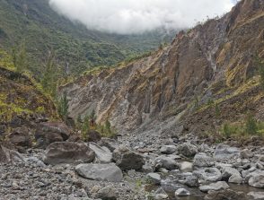
This a technical project which aims at developing new algorithms in order to model sensor from archived images acquired during the 20's century. We will first focus on areas with steep slopes and high contrast such as glacier covered regions in order to assess the accuracy of the methods. Then, we intend to apply our approach on a wide kind of landscapes.
Start: 01/01/2022
Coordinators : Antoine Lucas
Host institutions :
CNRS and IPGP
Related teams :
External Envelopes Geochemistry, Planetology and Space Sciences
Related themes :
Earth System Science
This is a technical project which aims at developping new algorithms in order to model sensor from archived images acquired during the 20\’s century. We will first focus on areas with steep slopes and high contrast such as glacier covered regions in order to assess the accuracy of the methods. Then, we intend to apply our approach on a wide kind of landscapes.