And yet, historical depth is an important element in understanding the evolution of continental surfaces, particularly in the context of climate change, where it is important to know how landscapes have evolved over the last century in order to anticipate future changes, by integrating inter-annual variability, extreme climatic events and the increasing anthropization of continental surfaces.
Today, space imagery data enables us to observe the Earth’s surface with sub-metric resolution, but does not allow us to study erosion processes on the scale of several decades, or even a century. On the other hand, there are archives of aerial images from numerous campaigns carried out over the last century in many countries. These data offer decimetric resolution and high image quality. However, although of great scientific interest, translating these silver images into topographic data is not straightforward. The digitization stage is generally carried out by government agencies, but is not always flawless, and the data is sometimes altered (distorted, missing parts, etc.). What’s more, once the images have been digitized, they need to be associated with a camera model that links the pixels in the image to the structures on the ground. This involves modeling the sensors, taking into account the properties of the camera used during the campaign, as well as the alterations caused by the digitization of the silver plates.
Finally, relief reconstruction must be sufficiently accurate to enable quantitative comparison of results from different campaigns over several decades. As the use of these data requires numerous manual and tedious steps, until now they have generally only been used for a one-off comparison of two dates, for example.
The young EROSAT team from LabEx UnivEarthS at the Institut de Physique du Globe de Paris and Université de Paris has therefore developed a complete algorithm for topographic reconstruction from these digitized archival images to produce time series of digital models of topography over a century. The authors of the study, published on November 4 in IEEE Geoscience and Remote Sensing Magazine, have rethought the way camera models are reconstructed. They have proposed a new method for recovering the initial geometry of the digitized photograph, so as to start again from data equivalent to digital images, while taking into account the shortcomings of digitization, but also the variety of images distributed in aerial campaigns over the course of the 20th century. In addition, they proposed a new approach for modeling sensors using homologous points that are stable over time, so as to associate scenes acquired at different times.
The result is a fully automated algorithm that uses digitized images from different campaigns over the same region to produce perfectly aligned digital terrain models over several decades, with metric to sub-metric vertical and sub-metric horizontal accuracies. These resolutions are equivalent to, or even better than, those offered by recent satellites, such as Pleiades for comparison.
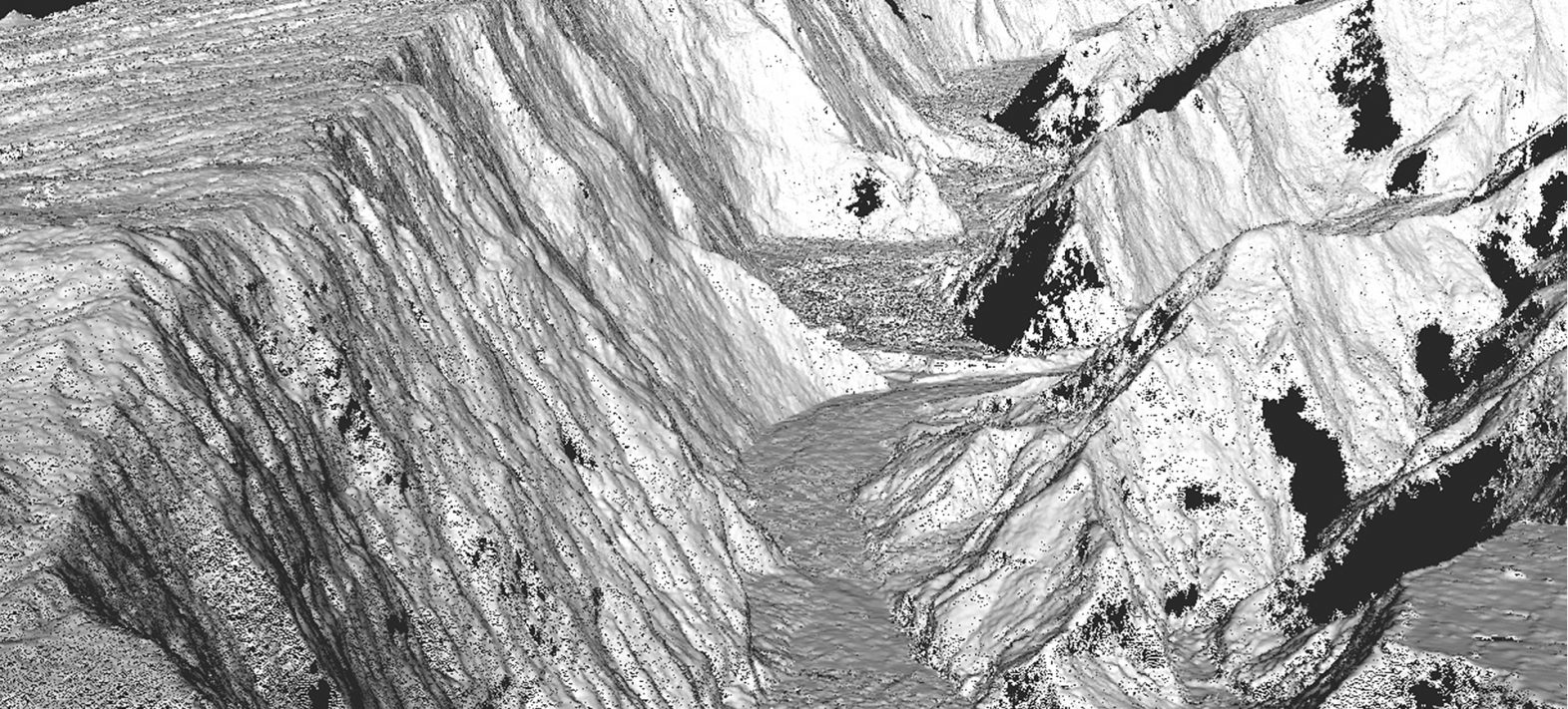
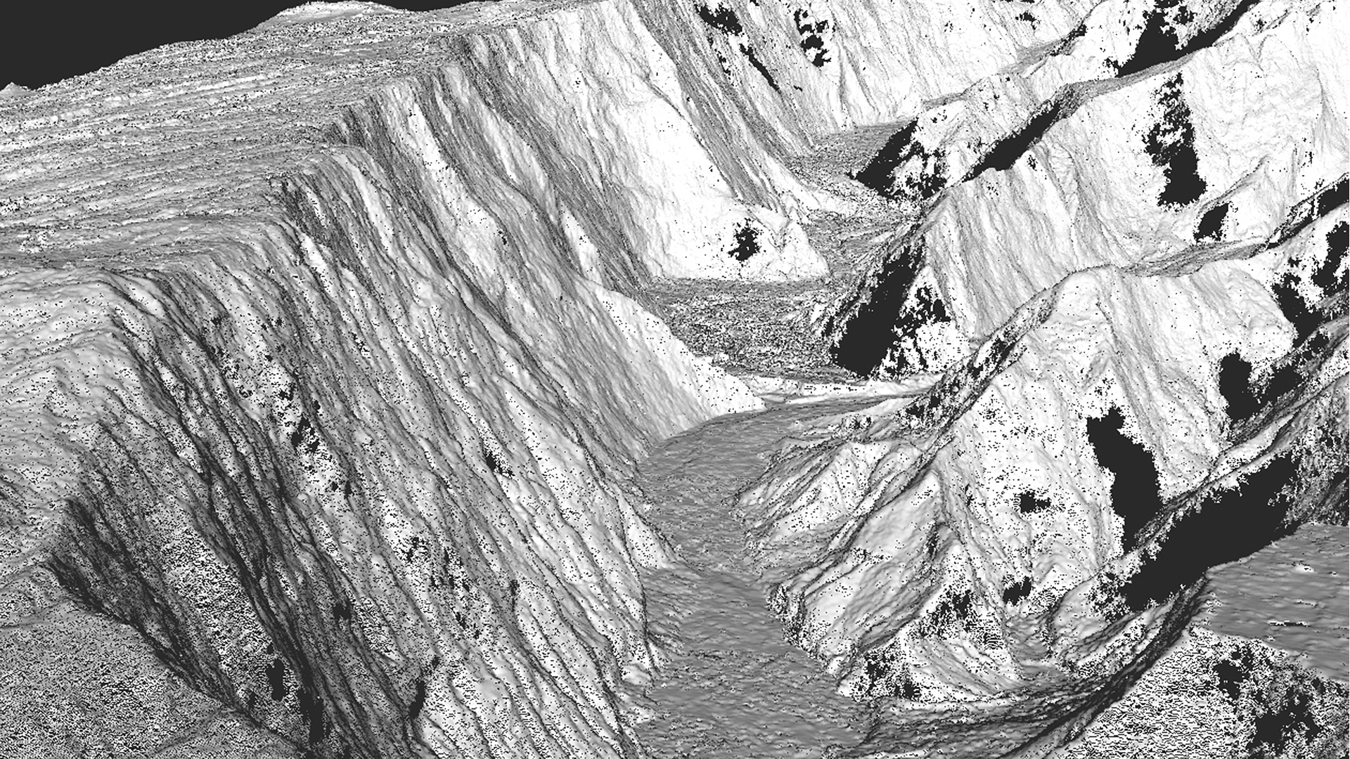
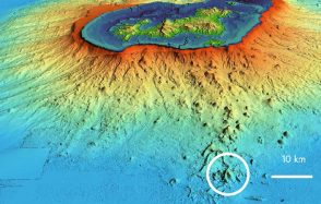
In this first publication, the application of the method has been tested and validated on two regions with marked relief and subject to rapid geomorphological change (the Alps and Reunion Island), demonstrating the interest of the method for the study of erosion and glacier movements. This new method could also be applied to studies monitoring the evolution of landscapes, vegetation or even the urbanization of a region.
Réf : A. Lucas and E. Gayer, “Decennial Geomorphic Transport From Archived Time Series Digital Elevation Models: A Cookbook for Tropical and Alpine Environments,” in IEEE Geoscience and Remote Sensing Magazine, doi:10.1109/MGRS.2021.3121370.